

Coastlines don’t fail all at once. They give way in tiny, ordinary moments: a stormy night, a saturated cliff, a beach that quietly thins year after year. In IB Geography, that slow change matters because exam questions rarely ask for one cause. They want the mix: why one stretch of coast retreats fast while another holds on.
If you can explain what controls coastal erosion rates, you can usually handle Option B essays, data-response questions, and evaluation of management. This guide gives you a clean, exam-ready way to structure it.
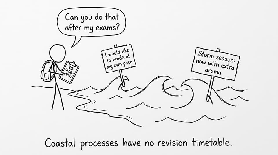
Coastal erosion rates: the IB Geography quick checklist
Use this when you plan a 6-, 10-, or 16-mark answer in IB Geography:
-
Wave energy: destructive waves, fetch, storms
-
Geology: rock type and rock structure
-
Coastal shape: headlands, bays, cliff angle
-
Weathering + climate: rainfall, freeze-thaw, sea-level rise
-
Human activity: coastal defences, land use, sediment supply
For a bigger syllabus anchor, start with IB Geography Option B: Oceans and Coastal Margins.
Wave energy: the engine of coastal erosion rates (IB Geography)
The fastest way to raise coastal erosion rates is to increase the energy hitting the shoreline. High-energy coasts tend to have powerful winds, long fetch, and frequent storm events. That energy drives hydraulic action (air compressed in cracks) and abrasion (sediment thrown against cliffs), especially during storm surges.
In IB Geography, don’t just say “storms cause erosion.” Add the time-scale point: one extreme event can remove months or years of material in hours, so erosion is uneven through time. If you need a fast refresher on the process-to-landform link, see Coastal Processes and Landforms.
Geology and rock structure: why some coasts crumble
Rock type shapes resistance. Hard, crystalline rocks (like granite) usually erode slowly; softer rocks (like clay) retreat quickly. But structure can matter as much as type: joints, faults, and bedding planes create weaknesses that waves exploit.
A classic IB Geography point is differential erosion: alternating resistant and weaker rock encourages headlands and bays, concentrating wave energy on headlands and reducing it in bays. For exam-style examples of erosion and deposition landforms, use B.2.2 Coastal Landforms of Erosion and Deposition Notes.

Coastal shape and slope: where energy gets focused
Coastline geometry controls exposure. Headlands experience wave refraction that bends wave fronts and concentrates energy, often increasing coastal erosion rates. Bays are more sheltered, so they tend to accumulate sediment and experience lower wave attack.
Slope angle matters too. Steep cliffs are vulnerable to mass movement when undercut or saturated, which can cause sudden retreat rather than slow wear. A strong IB Geography explanation links marine erosion at the base with sub-aerial processes above: the cliff isn’t just being “eaten by waves,” it’s being weakened by weathering, then removed by slope failure.
Weather, climate, and sea-level change: erosion’s slow pressure
Weathering helps waves do their job. Heavy rainfall can saturate cliffs, raising pore-water pressure and triggering slumps. Freeze-thaw widens cracks, making hydraulic action more effective.
Over longer timescales, climate change can raise relative sea level and potentially increase storm intensity or frequency, meaning wave attack reaches higher parts of the coast more often. In IB Geography, that’s a strong synoptic line: climate shifts can increase both the frequency (how often) and magnitude (how big) of erosive events.
To connect storms to coastal risk, revise B.1.3 Hurricanes and Their Impacts on Coastal Margins.
Human activity: protection here, problems there (IB Geography)
Humans change erosion by changing energy and sediment.
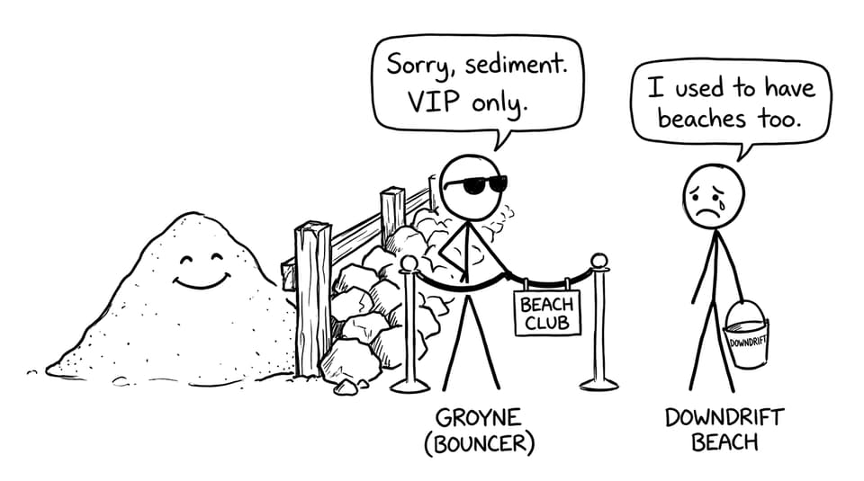
Hard engineering (sea walls, groynes, breakwaters) can reduce erosion locally, but it often disrupts longshore drift and starves downdrift beaches of sediment. With less beach material to absorb wave energy, coastal erosion rates can increase elsewhere.
That “elsewhere” point is pure IB Geography evaluation: management can transfer risk along the sediment cell rather than remove it. For structured evaluation language, see Coastal Management Strategies and the wider syllabus page IB Geography B.3 Managing Coastal Margins.
Exam tip: turn “factors” into a linked argument
When IB Geography asks what influences erosion rates, the best answers show interaction:
-
A storm (wave energy) hits a jointed, soft rock cliff (geology + structure)
-
Rainfall saturates the slope (weathering), triggering slumping (mass movement)
-
A groyne traps sediment updrift (human), narrowing the downdrift beach (less protection)
If you want more exam practice, use the Option B Questionbank and then pressure-test your explanations with RevisionDojo’s AI Chat and Grading tools.
Bringing it together (and revising it the smart way)
Coastal erosion rates are shaped by a system: wave energy sets the pace, geology decides resistance, coastline shape focuses (or disperses) energy, climate weakens slopes, and humans rearrange sediment and risk. That systems thinking is exactly what IB Geography examiners reward.
To revise this efficiently, build a one-page summary using RevisionDojo Study Notes, drill key terms with Option B Flashcards, and practise timed answers in the Questionbank. When you’re ready, use Mock Exams and Predicted Papers to simulate pressure, then refine weak explanations with AI Chat and targeted tutoring. IB Geography improves fastest when your revision turns into repeatable exam performance.