
If you have ever watched rain hit a school parking lot, you have already seen a drainage basin argument in miniature. Some water disappears into the ground. Some races across concrete like it has a deadline. A few minutes later, the drains start gurgling and the nearby stream rises. That small scene is the whole logic of IB Geography Option A in one moment: a drainage basin behaves like a living system with parts that constantly interact.
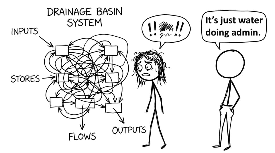
In IB Geography, examiners love drainage basins because they let you explain big outcomes (flooding, low flow, water quality change) using a clean systems model: inputs, stores, transfers (flows), and outputs. Once you can “speak system,” your answers become clearer, more structured, and easier to mark.
Drainage basin system checklist (exam-ready)
Use this quick checklist to anchor any IB Geography response:
-
System type: open system (energy and matter cross the boundary)
-
Main input: precipitation (rain, snow, hail, etc.)
-
Key stores: interception, soil moisture, groundwater, channel storage
-
Key flows: infiltration, percolation, overland flow, throughflow, groundwater flow
-
Main outputs: river discharge + evapotranspiration
-
Big idea: dynamic equilibrium (balance over time, not perfection every day)
For the full syllabus pathway, start with IB Geography Resources.
IB Geography basics: the drainage basin as an open system
A drainage basin is the area of land drained by a river and its tributaries, bounded by a watershed. In IB Geography, the crucial framing is that it is an open system: water enters, moves through, is stored temporarily, and leaves.
If you want the topic laid out exactly in the course structure, the RevisionDojo hub for IB Geography Option A Freshwater - Drainage Basins is the most direct map.
Inputs, stores, flows, outputs: how the system actually functions
Inputs (what enters the basin)
The major input is precipitation. Its type, intensity, and duration matter because they control how quickly water can enter the soil and how rapidly discharge rises. Short, intense rainfall is more likely to exceed infiltration capacity and trigger rapid runoff.
Stores (where water waits)
Stores slow the system down. Common IB Geography stores include:
-
Interception (water held on leaves and branches)
-
Soil moisture storage (water held in soil pores)
-
Groundwater storage (water in aquifers, feeding baseflow)
-
Channel storage (water held in the river channel)
A basin with large stores tends to respond more slowly to rainfall, often reducing peak discharge.
Transfers/flows (how water moves)
Flows connect the stores:
-
Infiltration (surface into soil)
-
Percolation (downward movement to groundwater)
-
Overland flow/surface runoff (fastest route to the channel)
-
Throughflow (lateral movement through soil)
-
Groundwater flow (slow, sustains rivers in dry periods)
To practise turning these terms into markband language, drill exam prompts in the Option A Questionbank.
Dynamic equilibrium: the calm idea behind messy rivers
Dynamic equilibrium is the quiet principle exam answers often miss. In IB Geography, it means inputs and outputs fluctuate, but the basin tends to maintain an overall balance across time unless something pushes it beyond its normal range.
A good way to phrase it in essays: the drainage basin “self-adjusts” through changing stores and flows (for example, higher soil moisture after prolonged rain reduces infiltration later, increasing overland flow and raising discharge).

For a deeper focus on basin response and risk, connect this idea to What Factors Influence Flood Risk in Drainage Basins?.
Human impacts: when the system gets rewired
In IB Geography, you are expected to link human activity to changed stores and flows:
-
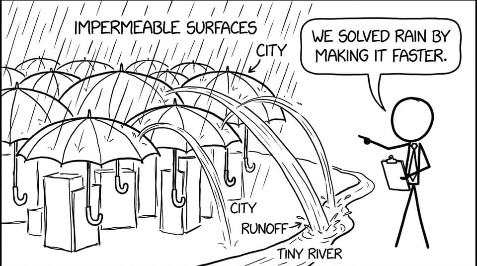
Urbanisation increases impermeable surfaces, reducing infiltration and increasing rapid runoff. Lag time shortens and peak discharge often rises.
-
Deforestation reduces interception, can increase soil erosion, and often raises overland flow.
-
Dams and abstraction alter storage and discharge patterns, shifting when and how water leaves the basin.
If you are revising A.1 specifically, this page is a strong backbone: A.1 Drainage basin hydrology and geomorphology. Then reinforce definitions fast using Option A Flashcards and A.1 Flashcards.
Conclusion: turn the system into marks
Drainage basins can feel like a diagram with too many arrows, until you realise the arrows are the point: in IB Geography, your job is to explain how water moves between inputs, stores, flows, and outputs, and why that movement changes over time. When you write in systems language, you naturally produce clearer evaluation of flooding, scarcity, and management.
To lock it in, use RevisionDojo as your revision loop: learn the structure with the A.1 topic page, memorise key terms with flashcards, and apply everything under pressure with the Questionbank. That is how IB Geography systems thinking turns into exam marks.